La Jolla Shores Entry
The primary sandy beach entry point located north of the sea wall. Enter here to access the shallow water corridors that lead toward the canyon rim.
Enter where the lifeguard towers indicate calm, breaking waves.
La Jolla Shores spreads across a half-mile crescent of kelp forest, canyon edge, and sandy channel—each zone distinct in depth, visibility, and marine density. This map breaks the underwater terrain into navigable segments, marking the reef clusters worth swimming toward and the current corridors to cross with caution.
Quick answer
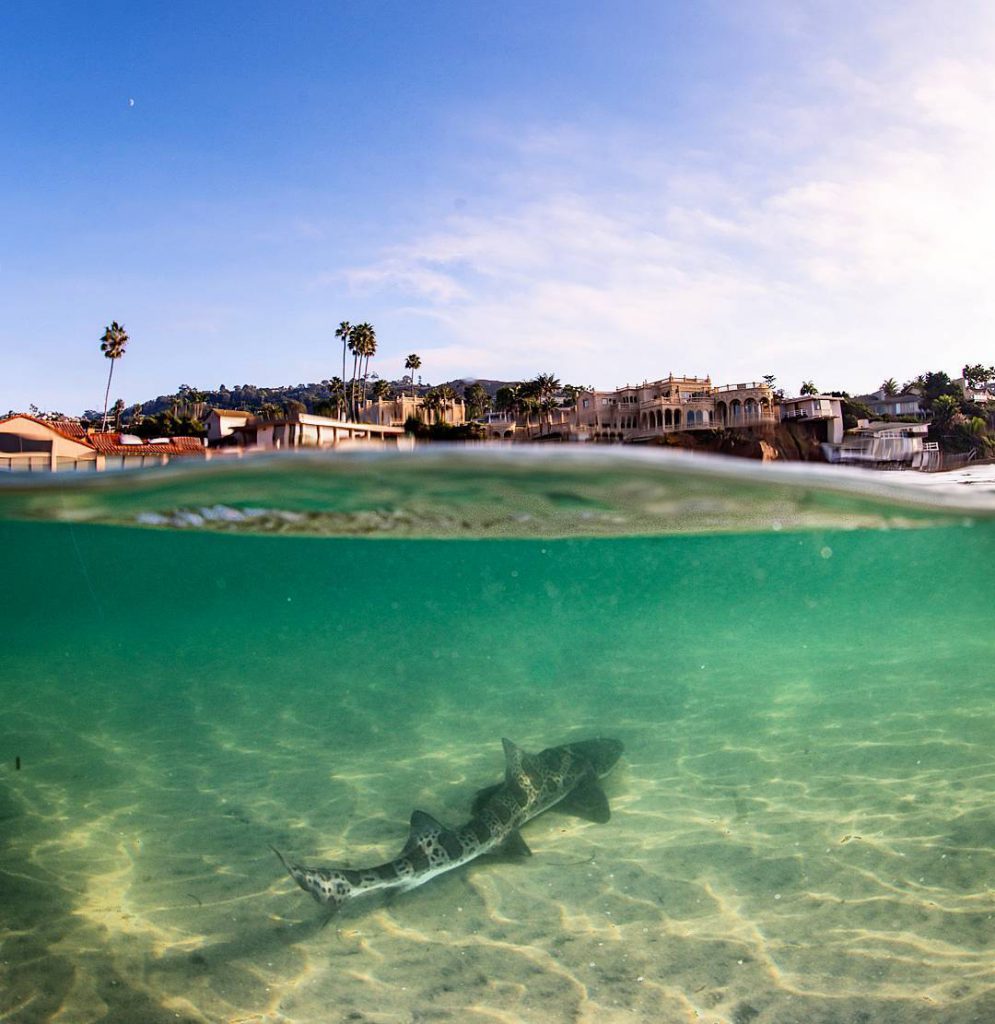
The la jolla shores snorkeling map divides the site into three primary zones: the kelp bed corridor along the northern boundary near Scripps Pier (depths 15–25 feet), the central sand channel with scattered rock outcrops (8–12 feet), and the southern reef shelf extending toward the Marine Room (10–18 feet). Most marine life concentrates along the kelp forest margin and the rocky transitions between sand and reef, where leopard sharks, rays, and garibaldi cluster during warmer months.
The kelp forest runs parallel to shore roughly 150 yards out, forming a natural corridor that filters current and shelters fish populations year-round. This zone holds the highest biodiversity per square yard—octopus, rockfish, sheephead, and juvenile sharks use the stipe tangle as both hunting ground and refuge. Water clarity here depends on swell direction; south swells push sediment offshore, while west swells stir the bottom and reduce visibility to ten feet or less. The central sand channel acts as a highway between the northern kelp bed and the southern reef shelf. Depths here rarely exceed twelve feet, making it the easiest zone for surface observation, but marine encounters thin out over open sand. Snorkelers crossing this zone should track the lifeguard towers on shore to maintain bearing—current drift is strongest mid-channel, especially during outgoing tides when water funnels toward the canyon drop-off beyond the kelp line. The southern reef shelf extends from Kellogg Park toward the Marine Room restaurant, marked by low-profile rock formations interspersed with sand pockets. This area attracts rays and flatfish that bury in sediment during daylight, along with schools of perch that cruise the reef edge at dawn and dusk. The la jolla shores snorkeling map highlights this zone as ideal for beginners due to consistent shallow depth and proximity to shore, though weekends see higher swimmer density that displaces skittish species toward deeper water. Navigation relies on visual landmarks rather than buoys—the Scripps Pier pilings to the north, the lifeguard tower cluster at mid-beach, and the Marine Room's pilings to the south provide fixed reference points. Underwater, the transition from sand to rock signals a shift in depth and current behavior. Snorkelers should enter near Kellogg Park where the sand channel widens, swim north along the kelp margin to maximize marine sightings, then return via the shallower inshore route to avoid fighting the prevailing southward drift that intensifies after midday.
“The kelp forest margin holds the highest biodiversity per square yard, where octopus and juvenile sharks use the stipe tangle as both hunting ground and refuge.”
The La Jolla Underwater Park encompasses distinct zones featuring varied reef structures and sandy corridors suitable for snorkeling. Understanding these primary zones and designated access points ensures a safe and navigational approach to the marine reserve.
The primary sandy beach entry point located north of the sea wall. Enter here to access the shallow water corridors that lead toward the canyon rim.
Enter where the lifeguard towers indicate calm, breaking waves.
A deep, submerged canyon that drops off sharply near the reef zones. It creates a diverse habitat for marine life, though it is best suited for experienced swimmers.
View the drop-off ledge from the surface near the kelp.
A rocky reef formation populated by bright orange Garibaldi fish. This zone consists of shallow rocks and kelp beds located within reach of the shore.
Look under rock ledges to spot resting marine life.
The ecological reserve zone stretching from the beach to the cove. This area prohibits the removal of any marine life or objects.
Check the posted signs for specific boundary demarcations.
The outer boundary of the reef where tall kelp stalks grow from the ocean floor. It serves as a natural shelter for various fish species and sea mammals.
Scan the vertical stalks for camouflaged sea creatures.
The best arrival window is 08:00–11:00, which offers the best water clarity and lower visitor crowds. Planning your snorkeling excursion during these hours helps ensure calmer conditions and easier navigation of the underwater terrain.
70°F to 75°F water temps
Expect busier conditions and warmer water temperatures throughout the day.
58°F to 62°F water temps
Water is cooler, often requiring a thick wetsuit for extended snorkeling.
—
This period offers the quietest experience and highest visibility for exploring the reefs.
68°F to 72°F water temps
These months often feature calm seas and warm water, ideal for snorkeling.
Verdict: The best time to visit is weekday mornings between 08:00–11:00 during the months of September or October.
La Jolla Shores is open to the public daily for snorkeling and beach activities. The site maintains consistent operating hours throughout the week.
Access to La Jolla Shores beach and the surrounding cove is provided as a public service. There are no fees required to enter the beach or participate in snorkeling activities.
Verdict: A typical adult pays 0 USD to access the water, with costs only applying if you choose to rent equipment or book a guided tour.
La Jolla Shores is located at 8200 Camino Del Oro, La Jolla, CA 92037, USA. The most accessible approach for snorkelers is via the main beach entrance near the Kellogg Park parking lot.
Interstate 5 to La Jolla Village Drive, proceed west to Torrey Pines Road then left onto La Jolla Shores Drive
MTS Route 30 to La Jolla Shores Dr & Paseo Del Ocaso
Walk from Kellogg Park directly onto the sand toward the north end of the beach
Parking at the Kellogg Park lot fills quickly, so consider arriving early to secure a space near the beach access point. Once parked, proceed to the north end of the beach for the shortest walk to the primary snorkeling entry areas.
Everything you need to know about la jolla shores snorkeling map
You can find an accurate la jolla shores snorkeling map by visiting the official lifeguard website or referencing local signage at the beach. These resources outline the protected marine zones and safe entry points for visitors.
While not strictly required, a la jolla shores snorkeling map helps beginners identify safe swimming corridors and avoid rocky hazards. It provides essential context on where currents are typically manageable for those new to the activity.
The primary areas for observation include the shallow reefs near the beach and the deeper sections towards the cove, which are highlighted on any detailed La Jolla underwater guide. Snorkelers often spot garibaldi and leopard sharks in these protected marine habitats.
The entrance fee is 0 USD as there is free entry to the beach and cove for all visitors. This allows everyone to access the coastal environment shown on your la jolla shores snorkeling map without purchasing a ticket.
The best arrival window is 08:00–11:00 for the best water clarity and lower visitor crowds. Arriving during this period ensures easier parking and better visibility before the afternoon wind picks up.
Families are welcome to explore the shallow areas indicated on the snorkeling route map, provided they wear appropriate safety gear. It is important to stay within the designated lifeguard-supervised zones while exploring with children.
Public facilities including restrooms and showers are located near the main beach access points. These amenities are convenient for rinsing off after exploring the reefs mapped in your la jolla shores snorkeling map.